

Southwest Drone Services
With over 10 years UAV experience and utilising the very latest in Drone Technology Southwest Drone Services is your local provider of exceptional aerial content and services.
Our drone footage has featured on the BBC and also in professional movie productions.
We live in an ever changing world with technology advancing at an incredible pace, one such area of rapid development is UAS (Unmanned Aerial Services).
Applications for new the generation of Drones are ever growing with new technology emerging every day.
The advancements in camera technology has also played an important roll in what is achievable with todays drones.
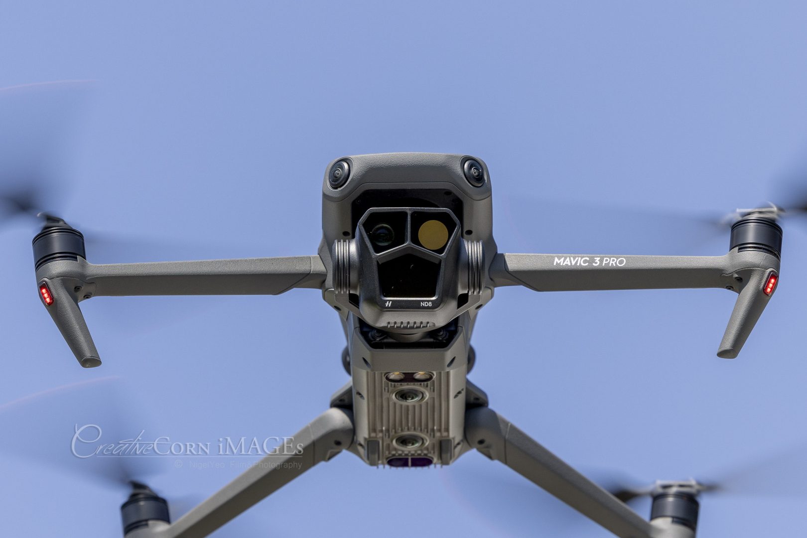
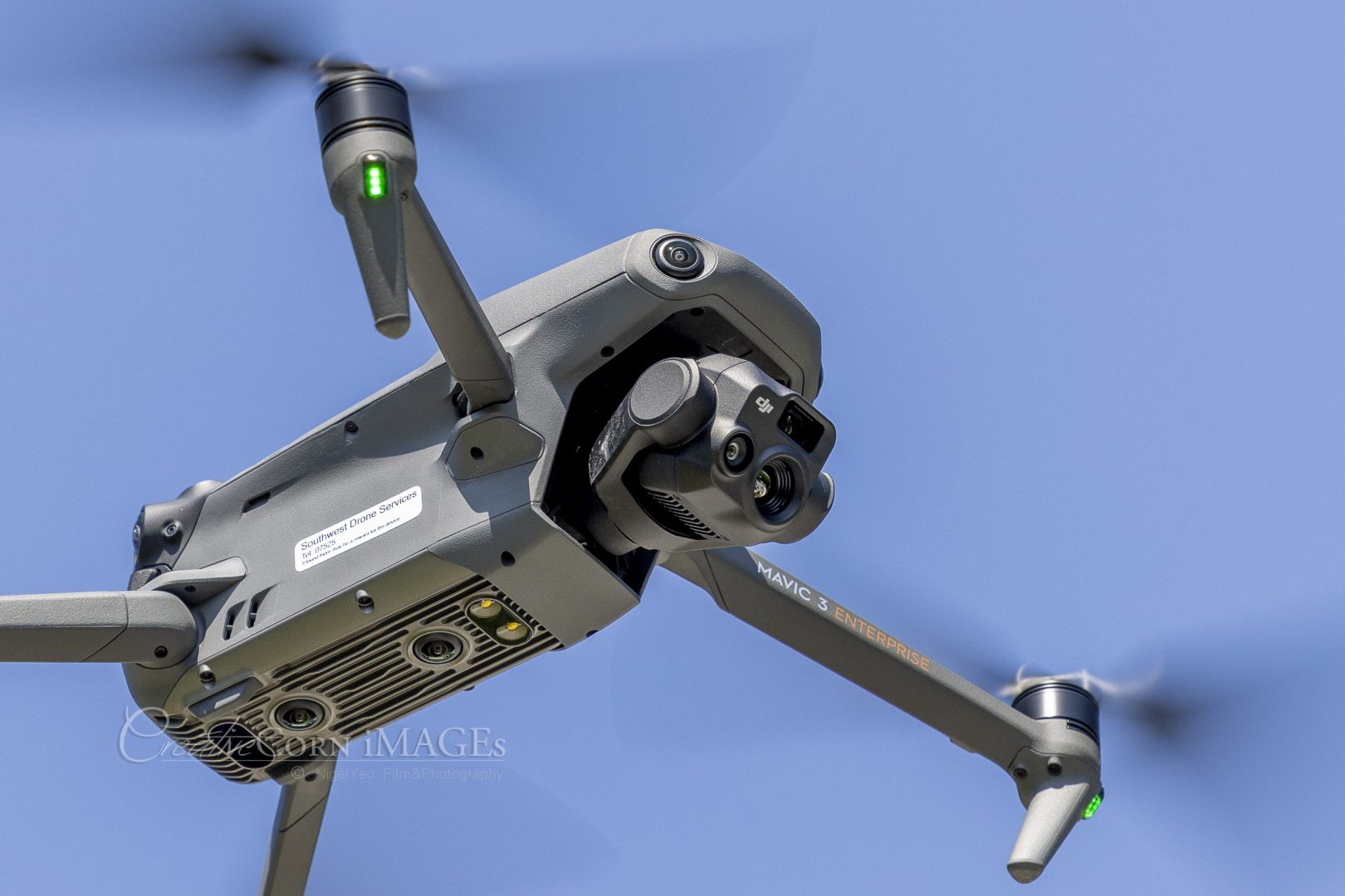
Once large and cumbersome “Thermal imagining” and “Multispectral” camera’s are now mountable on small agile drones opening up once unthinkable services at more affordable costs.
Why use a Drone Inspection Service?
A visual drone inspection is an incredibly efficient way of obtaining a thorough visual check on your assets, whether a power line, wind turbine, or a building. The imagery can be collected during a short drone flight and then reviewed in detail later on.
Physical maintenance can be scheduled more efficiently and targeted only on the areas which have been highlighted.
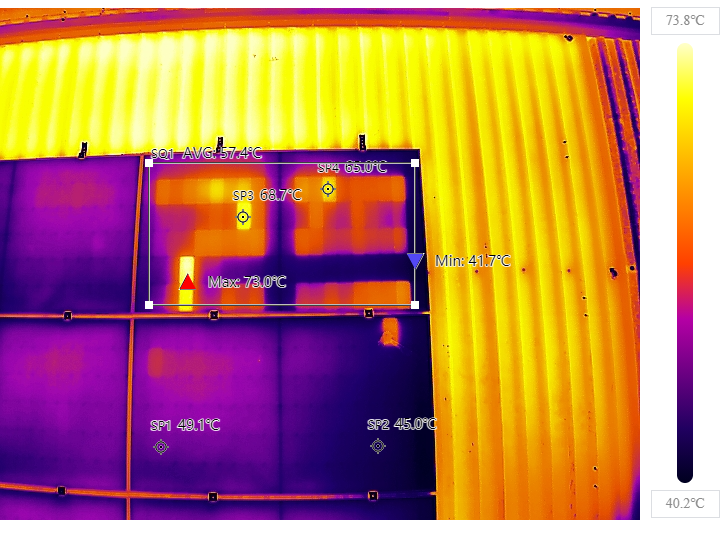
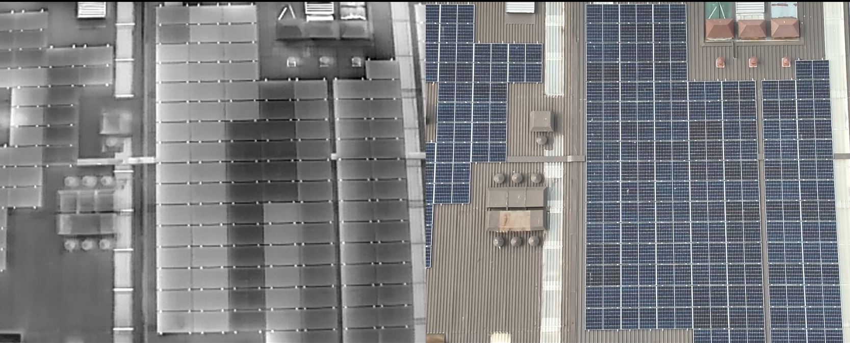
In this example we are scanning 1600 panels in just 2 minutes with none of the risks associated with working at height!
REDUCE RISK
Using drones for inspection can dramatically reduce the risks associated with working at height!
Put an eye in the sky
Let our drone survey your roof and potentially save thousands on scaffold.
State of the art equipment (Thermal Imaging)
Thermal imaging cameras equipped to our aerial drones are state of the art 640×512px industry standard and can be used to identify: Read the full spec here…
- Heat and cold air loss
- Common Solar Panel issues
- Roof leaks
- Missing insulation
- Thermal bridging
- Possible causes of damp
- Leaking pipes
- Structural Weak Points
- and much more
Utilising the latest in drone technology we are able to provide outstanding footage with he minimal disruption or interference to the surroundings.
By using drones for inspection you will reduce the risks associated with working at height!
Maximise you investment!
The installation of solar panels can offer great long term savings, in order to maximise your investment it is advised regular inspections are undertaken to ensure efficient operation.
Using Thermal imaging technology we are able to efficiently detect common faults with solar panels, from individual panel failure, shading and soiling to possible installation issues. Early detection of faults is essential and can reduce costly repairs later and if nothing is wrong peace of mind.
A typical domestic solar panel system can be scanned in a matter of minutes with the resulting images being processed and analysed back at the office. See more about issues a domestic inspection highlight…
Common issues include
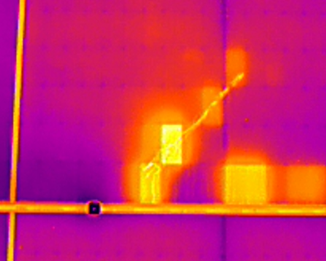
Hot-Spots
Panel fault/failure, hot-spots detected on the thermal image indicate panel failure, although rare in extreme cases faulting panels can combust or cause the mounting hardware to ignite so replacement is advised.
Panel string installation faults
Possible panel string installation fault (Black hot), more common on larger installation.
Detailed thermal reports
Reports produced as deliverables, both Thermal and Hi-Res RGB images are supplied. Reports can be branded as your company if desired.
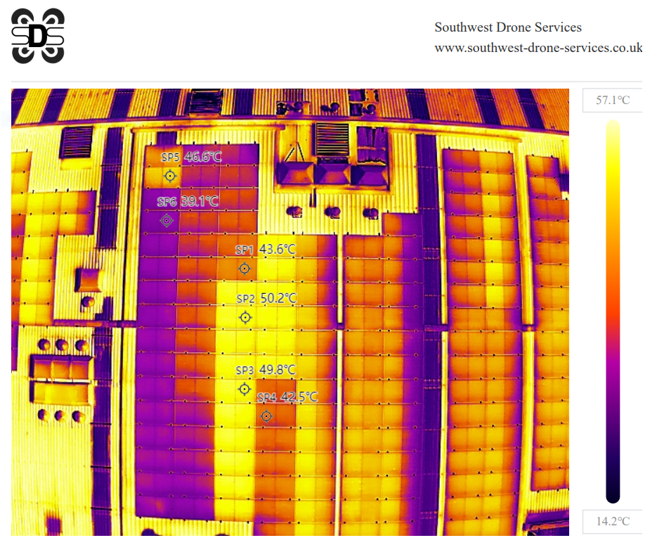
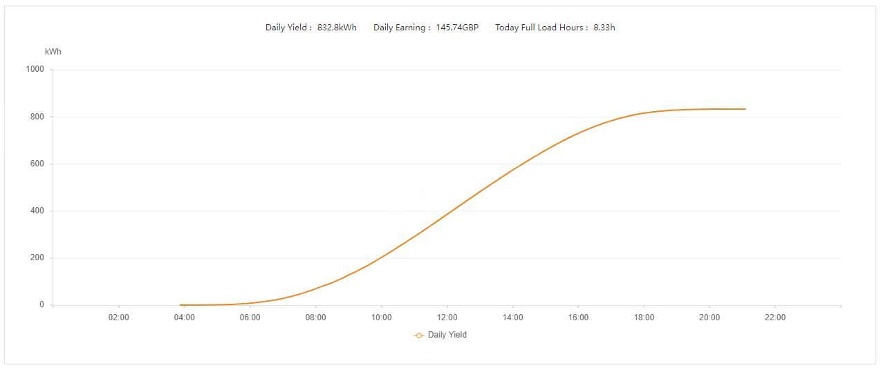
The above report was provided to the panel installer who used it to quickly locate the fault, the result was an increase in Daily Yield from 355.2kWh to 832.8kWh!
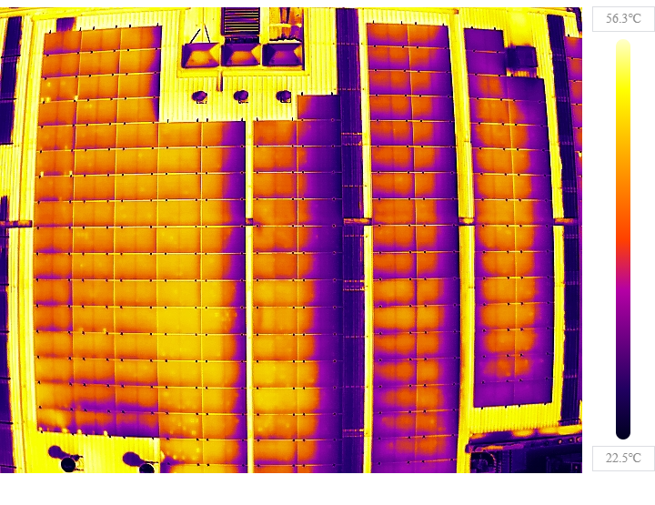
After the corrective action the panels were rescanned to confirm completion.
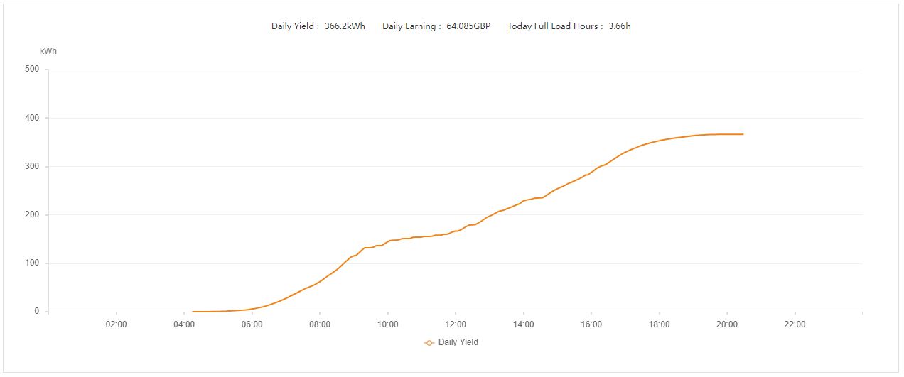
Without the Thermal scan the Solar Panel owner was unaware of the issues and the revenue which was being lost. The installer was able to quickly rectify the fault saving a potentially large customer claim when the the panels and or inverter had failed later.
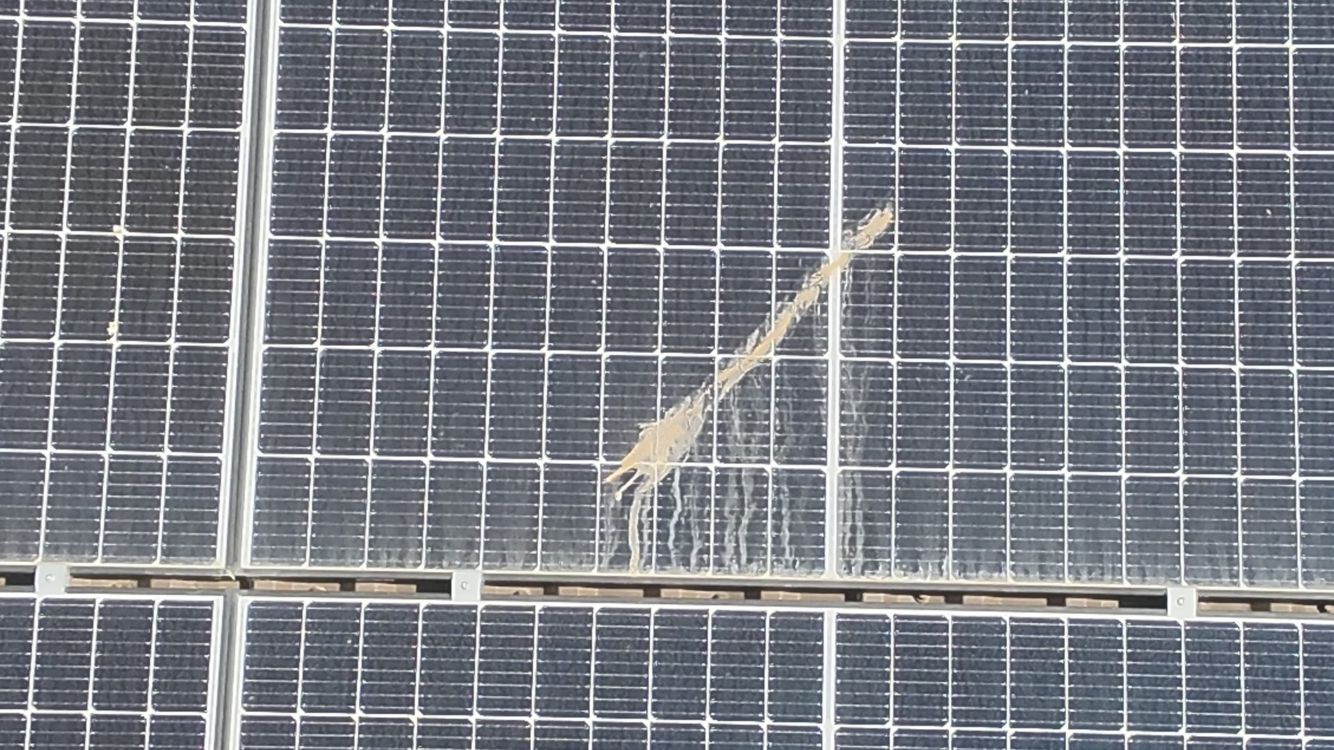
Heavy Soiling
Soiling can cause panel hot-spots and if not cleaned can cause permanent damage and premature panel failure.
Studies have shown that a thermal scan of a residential property can yield an energy saving of 17%* per year.
*Dependent on property and measures put in place to rectify the areas highlighted. Saving is first year saving and not year on year.
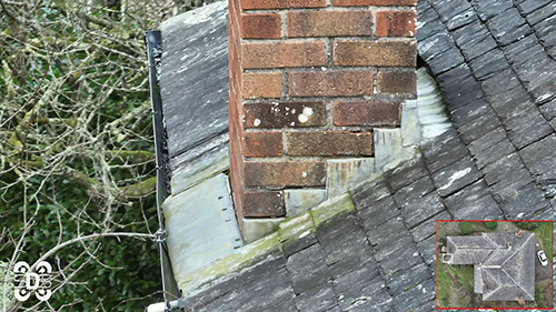
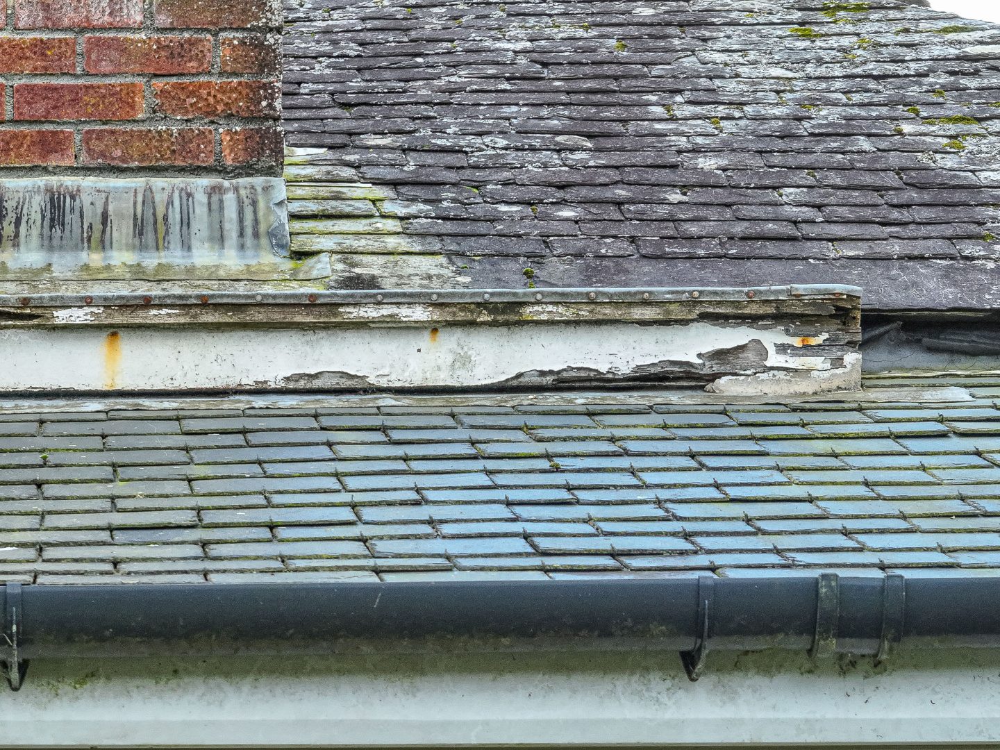
Domestic Solar Panel Check and Roof Inspection
We use our High resolution camera’s and Thermal cameras to inspect domestic roof’s, where solar panels are also installed by combining both technologies we are able to efficiently capture your roof condition in one short flight and analyse the images later producing a detailed report of our findings.
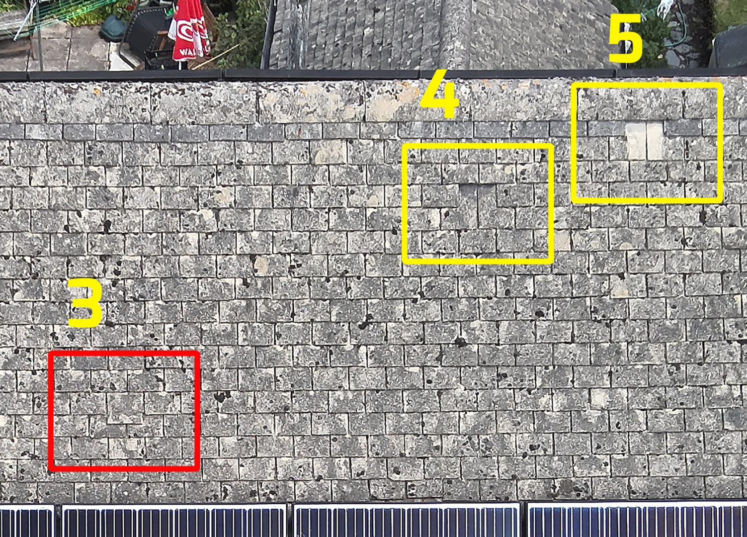
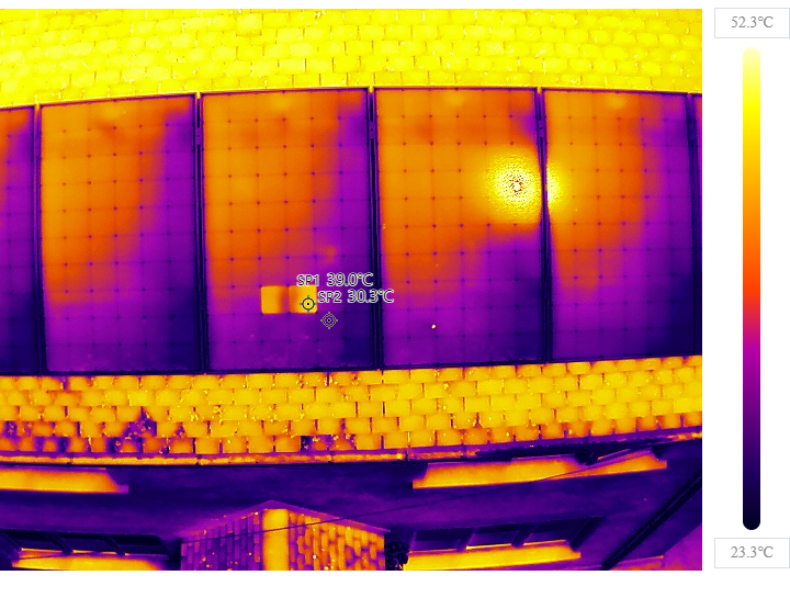
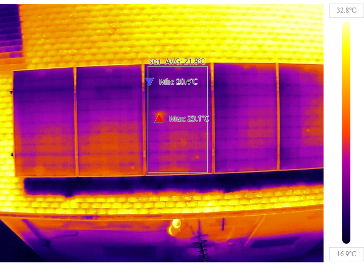
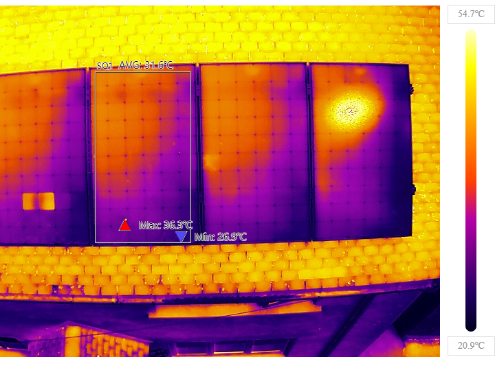
In this typical inspection a number of tile issues where highlighted.
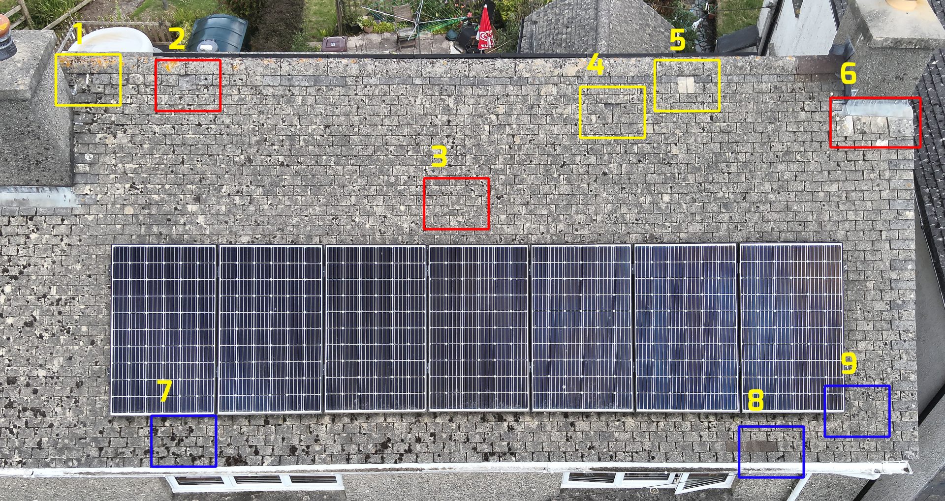
The Solar Panels were also scanned with only minor issues discovered. This property had panels fitted to both front and rear elevations, the Thermal image clearly shows the effect of sun angle as the rear panels were not working as efficiently as the front, the average panel temperature on the front was 31.5° C and the rear only 21.8° C, a quick sun angle check confirmed had the scan been done in the morning the efficiency would have been reversed, on visual inspection when comparing elevations the rear panels also suffered with increased soiling further reducing there output.
A panel clean was advised to maintain efficiency.
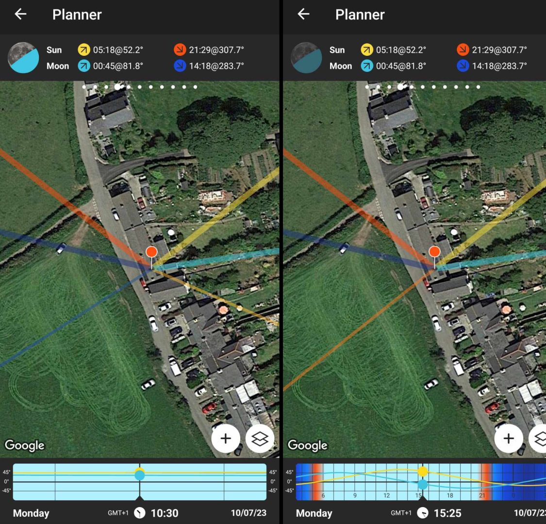
2D and 3D Mapping
We use our Drones to create 3D maps. Our drones and quickly and efficiently collect image to create 2 and 3D maps. Maps can be shared and annotated.
We also scan for electrical defects, excessive heat caused by faulty or overloaded outlets can be quickly identified.
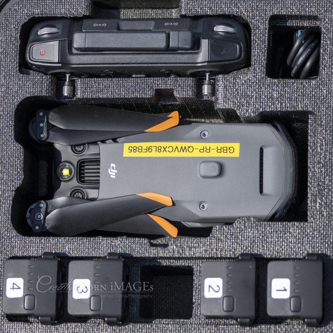
Read more about the Drones we use…
Safety is paramount, drones can be dangerous! where possible we will always use the smallest and lightest drone possible to reduce any risk of injury or damage, we comply strictly to the CAA regulations The Air Navigation Order (ANO) CAP393 and CAP722 which lays out the conditions and limitations for any Unmanned Aircraft PDRA developed and published by the CAA.
We use Enterprise/Professional grade equipment with the highest level of protection from equipment failure utilising omnidirectional obstacle avoidance systems ensure our drones do not collide with your property.
In the unlikely event of failure our pilots are cover by insurance which is fully compliant with EU Regulation (EC) No 785/2004.
You can read more about importants of safety and Drone operational limitations here…